
The information on this page corresponds to
Version 1.0
If you are using another version of Terra Antiqua, select it below.
Fill gaps
Some areas may end up missing elevation values. This issue is common for paleogeographic maps because, after rotating present-day topography / bathymetry, gaps can appear between blocks. These gaps represent areas where the topography / bathymetry was destroyed by deformation or subduction of a crust portion.
This tool is intended to interpolate values for these gaps. It generates elevation data in each empty pixel by averaging pixel values around it, using inverse distance weighting. There is the option to use it on the entire map or constrain it to a region.
The inverse distance weighting (IDW) interpolation method, implemented in the GDAL library, is a fast algorithm to fill the empty pixels (NoData values). The Fill gaps tool gets NoData values from the raster's metadata and seeks their position to be able to fill these areas, interpolating between the surrounding valid values.
For very large areas a more realistic outcome may be obtained by creating new topo/bathymetry using the tool Create Topo / Bathymetry ![]() .
.
Step by step
-
Click on the icon

In the field How would you like to process the input DEM, choose Fill gaps.
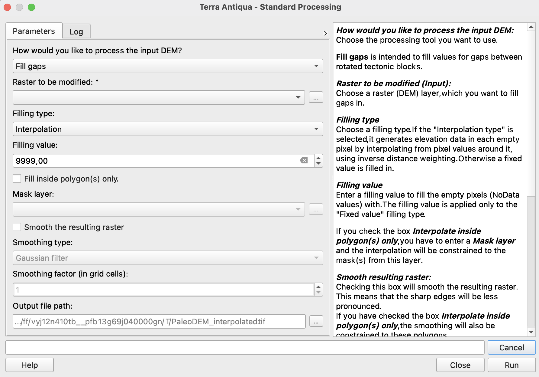
In Raster to be modified, choose the DEM you want to fill gaps in.
-
If you have a set of masks you want to limit the interpolation to, check the box Interpolate inside polygon(s) only. In this case, you will have to select the layer containing these masks in the field below. If you want to fill the gaps in the full extent of the map, skip this step and leave the box unchecked.
If you want to smooth the output raster once all gaps are interpolated, check the box Smooth the resulting raster, select a smoothing type, and a smoothing factor. Otherwise, skip this step.
-
Choose the Output file path, and click Run.
If you have selected the option to Interpolate inside polygon(s) only in step 4, the smoothing will be constrained to the same polygon(s) as the interpolation.