Troubleshooting
Known issues and Workarounds
This table lists all known issues and errors the user may face while using Terra Antiqua. We are aware of these issues and are working on definitive solutions. The situations mentioned in this page are not integrated in the other sections of this manual because they do not concern everyone (probably only a minority of users) and only happen in particular cases.
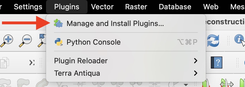
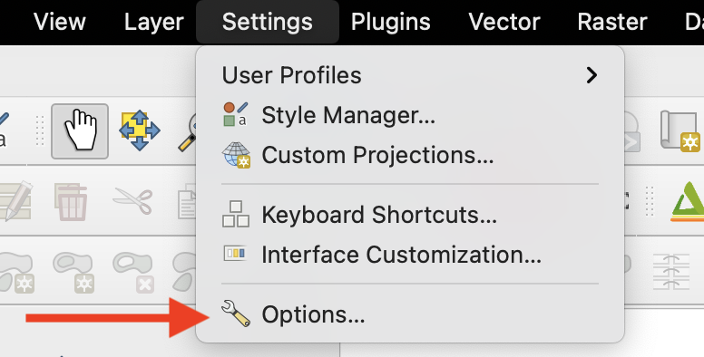
In order to identify many of these issues, you will need to pay attention to the Log tab of the Terra Antiqua tool you are using, or open the Log Messages Panel: instructions to open the panel
| Issue | Explanation | Workaround | Related tool(s) |
|---|---|---|---|
| In the parameter window, the option selected features only isn’t available. | You have to select the features on the map canvas before choosing the vector layer in the parameters window. If you don’t do it in this order, the option does not activate. |
|
|
| When generating two different maps for the same period, if you have used different smoothing factors, the shorelines may be different. | The smoothing factor is the base of the algorithm. The resulting map is fundamentally affected by the value you choose. The shorelines thus have considerable differences depending on the smoothing factor. | Use the tool Set Paleoshorelines after the tool smooth raster with the same parameters for both maps.
|
Smoothing |
| Most of the tools don’t work and the Log Messages Panel shows a processing error gdal:rasterize , or another error related to gdal. Terra Antiqua can’t find the GDAL algorithms it uses to perform most of its tasks. |

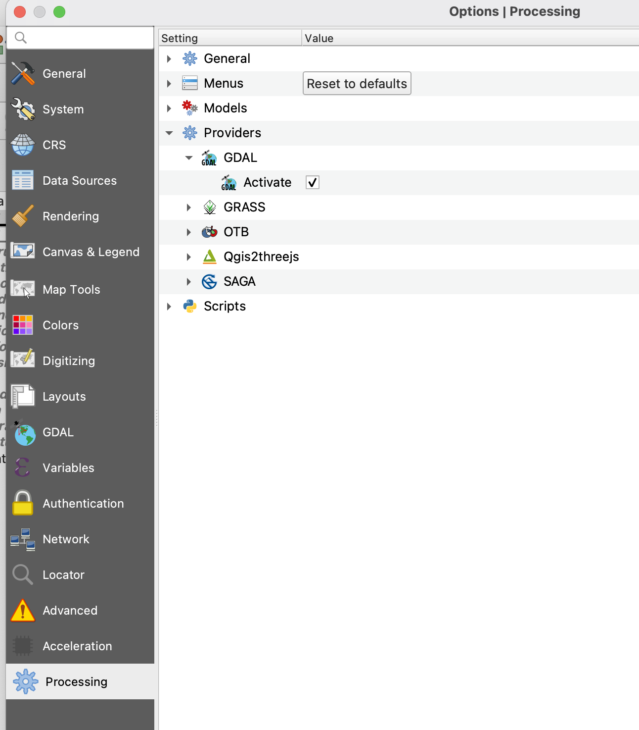
|
Most of the tools | |
| You get an error message saying that one or more layers in your project have a different CRS (Coordinate Reference System) from the one used in the project. | One or more of the layers on your map canvas have a CRS that doesn’t match the main CRS of the project. For Terra Antiqua to work, all polygon and raster layers must have the same CRS. | Make sure all the layers loaded into your map canvas have the same CRS, and reproject the ones that don’t (drop-down menu Raster > Projections). If a layer doesn’t have a CRS, you need to georeference it using the appropriate CRS (Plugin: Georeferencer GDAL). | All the tools |
| The Compile Topo/Bathymetry tool doesn’t work and the Log tab displays an error saying that the raster layers have different sizes. | The tool Compile Topo/Bathymetry needs the rasters it compiles to have exactly the same size, and the layers you are trying to compile don’t have the same size. | The Log tab of this tool lists the layers with different sizes. Check all these layers and make sure the ones you use next have the same size. | Compile Topo/Bathymetry |
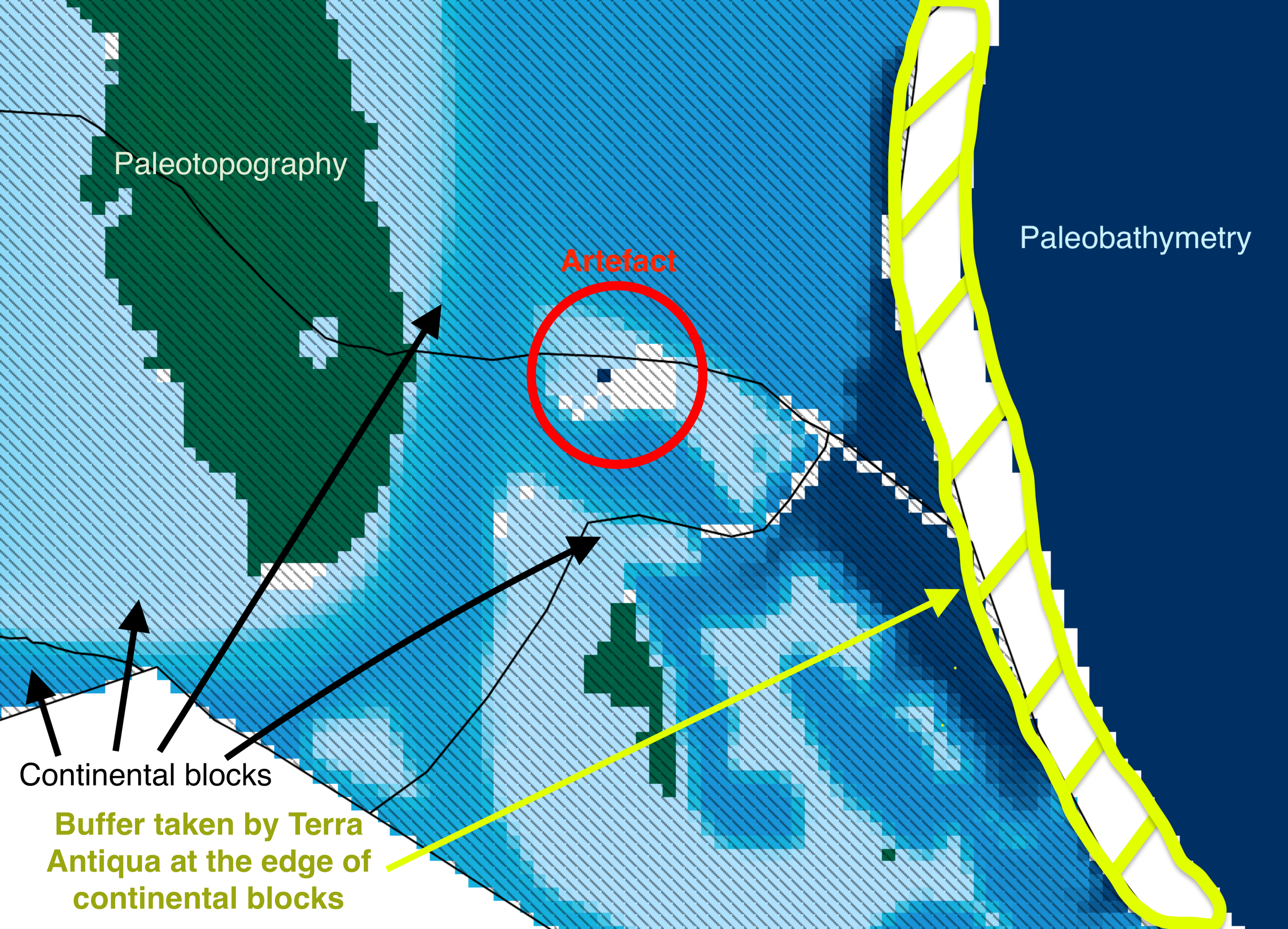
This is not a bug of Terra Antiqua. We have noticed that GPlates erases the pixel values equal to 0 (and replaces these with No Data values) when the present-day topography raster is rotated. This creates gaps in the topography raster for areas that have an elevation equal to 0 and are located within a continental block (e.g.: Bahamas, northern and western shores of the Gulf of Mexico) |
Use the tool Remove Artefcts to remove those artefacts from the compiled raster. | Compile Topo/Bathymetry | |
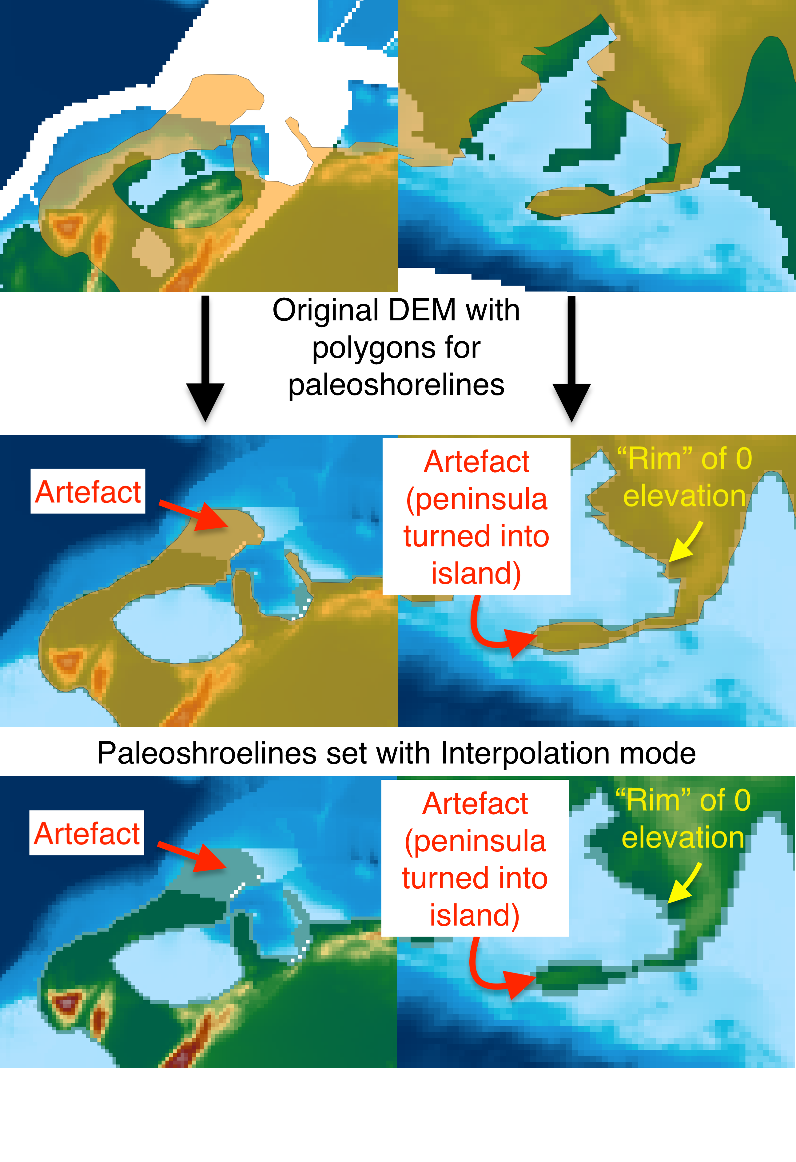
This is due to the fact that the algorithm sets the shorelines fixed to the polygons edge, creating a "rim" of 0 elevation pixels. Depending of the resolution of the map and the source data (i.e.: the topography, bathymetry, rotation model, etc.) there are regions where the interpolation is likely to generate artefacts. |
Use the tool Remove Artefcts to remove those artefacts from the shorelines. or Run the Set Paleoshorelines tool with the Rescaling mode. | Set Paleoshorelines | |
If you are a developper and think of a technical solution to any of these issues, please refer to the section Contributions.
To suggest new issues to add to the list, or give feedback on the ones already there, please comment below or fill in this form: Feedback & bug reports.