Prepare Masks
Vector polygon masks stored in shapefiles play a central role in Terra Antiqua because they control the area where topography and bathymetry are modified/created, and they can also contain attributive information used by Terra Antiqua’s algorithms.
Often, Gplates works not only with polygons but also polylines to represent the masks. Then the output consists of separate shapefiles.
This tool allows polygonization of masks to combine them into a single shapefile to make it easy to work with them. Like the Compile Topo/Bathymetry tool, the masks are combined in order, and overlapping masks clip underlying ones.
Polygons can also contain error-prone invalid geometries that need to be fixed before they can be used in Terra Antiqua. These invalid geometries are solved by the present tool.
Step by step
-
Click on the icon
Enter in the table the different mask layers that need to be merged.
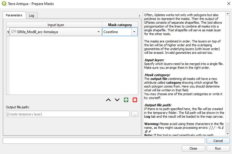
The arrangement of the layers is important. They are combined in order. The layers on top of the list will be of higher order and the overlapping geometries of the underlying layers (with lower order) will be erased. Use the buttons at the bottom of the list to add, remove, and arrange rows:


The output file combining all masks will have a new attribute called category showing what the original file for each polygon was. In the column Mask category, you should determine what will be written in that field.
Choose the Output file path, and click Run.